

|
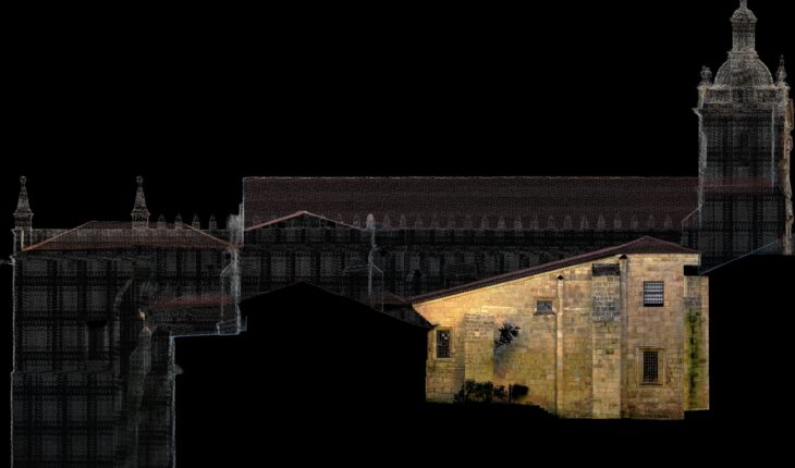
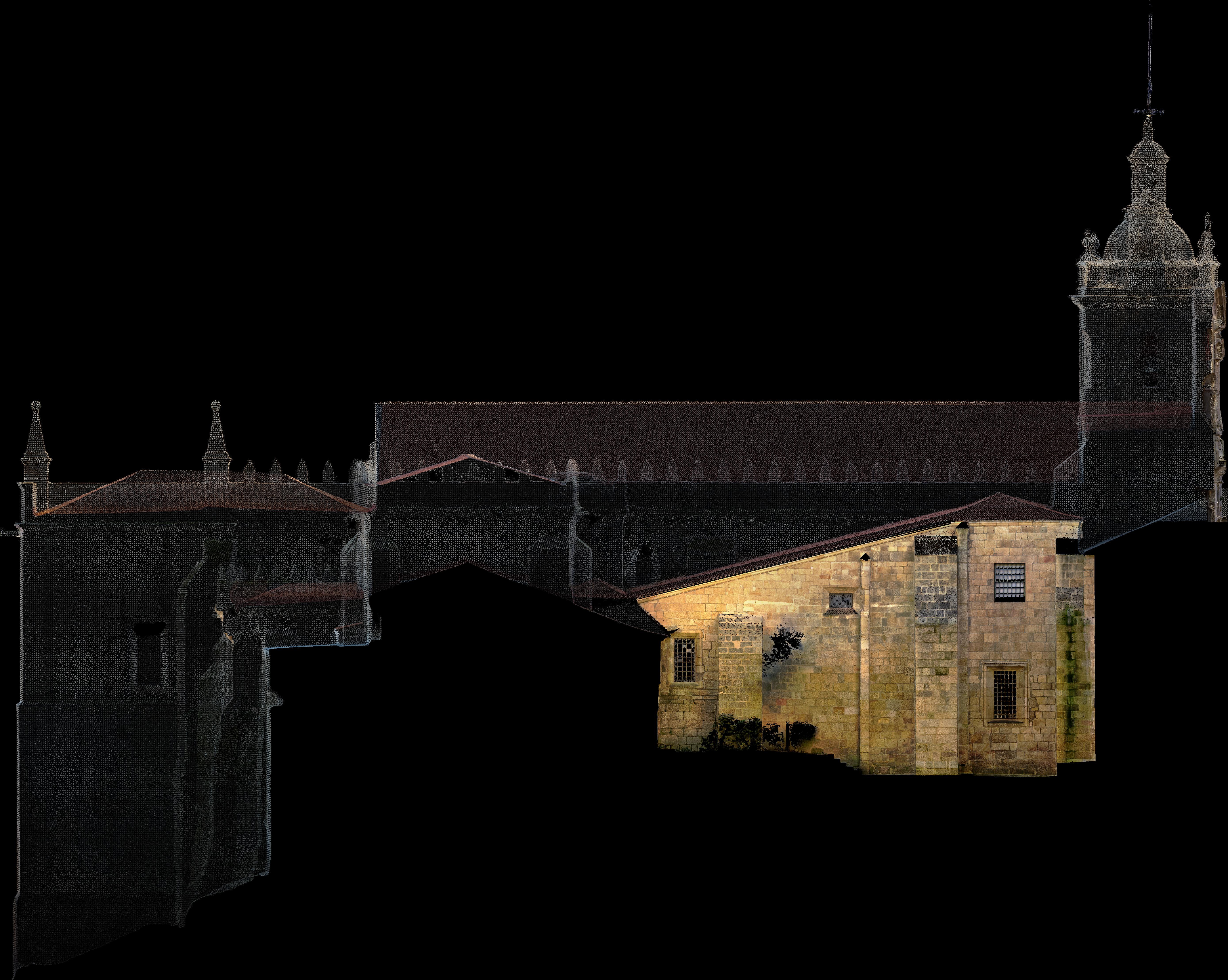
Hello everyone! I’m working on a project where I need to generate high-quality orthophotos of building facades to allow pathology drawings to be done directly on-site. The survey was mainly carried out using aerial photogrammetry, with some areas complemented by laser scanning. However, since the point density varies between the two techniques, this difference becomes noticeable in the final TIFF projection I’m generating in CloudCompare (where I merged the point clouds). While generating orthophotos in plan view seems more straightforward, I find the process for facades to be more challenging, and I’m unsure if I’m following the best approach. I’d like to ask: how do you usually generate orthophotos of facades? Any recommendations for software or tips to improve the workflow? Thanks in advance for your help! submitted by /u/nu__no |


